
Design. Plan. Monitor.
Abyssal Cloud provides an enhanced 3D Digital Field view, with accurate GIS positioning and Contextualized Data of the entire subsea environment. Instantly access all your videos and projects controlling how your data is used and shared.
It can incorporate project data extracted from any source (Esri, SAP, PI, etc), and can be connected to any other operational platform.
Live Operational Visualization
Worldwide Project Data & Video
Field Design Optimization
Reduction of Operational Risks
FEATURES
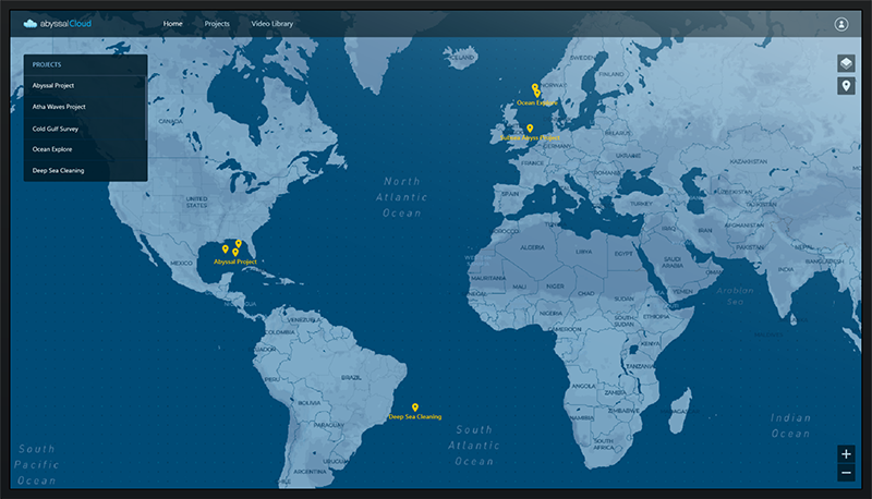
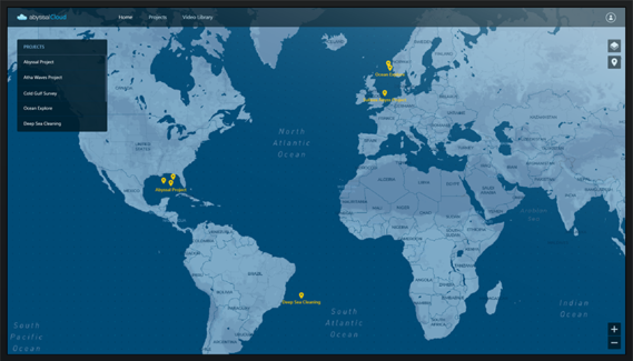
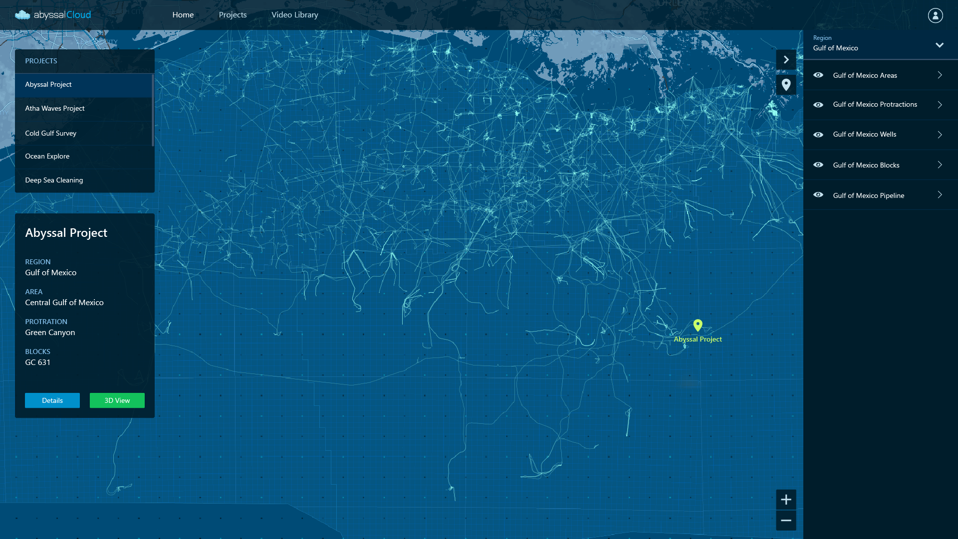
Geographical Project Management
2D GIS application to visualize all your world-wide projects, with contextualized data.
Providing for full project transparency.
Providing for full project transparency.
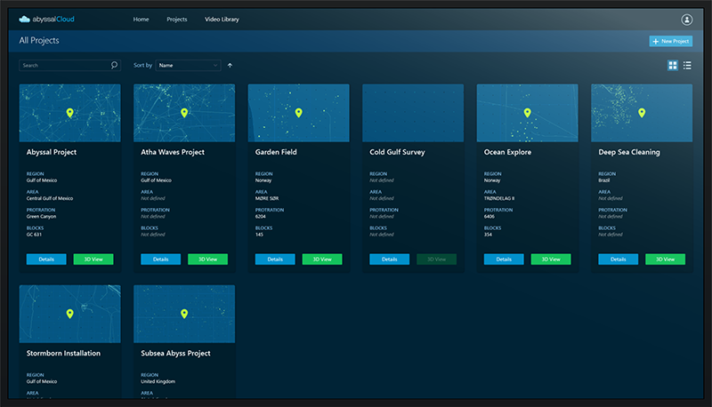
Project Portfolio Management
Worldwide project data in a single visualization platform – Abyssal Cloud – that can be linked to other platforms for KPI information.
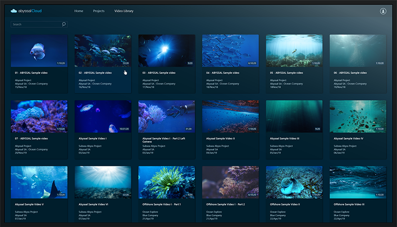
Video Library
Comprehensive database that can be used to store offshore videos with data correlation.
It allows users to select, visualize and play videos with or without audio.
The navigation between the videos and their organization can be custom made based on client’s needs.
It allows users to select, visualize and play videos with or without audio.
The navigation between the videos and their organization can be custom made based on client’s needs.
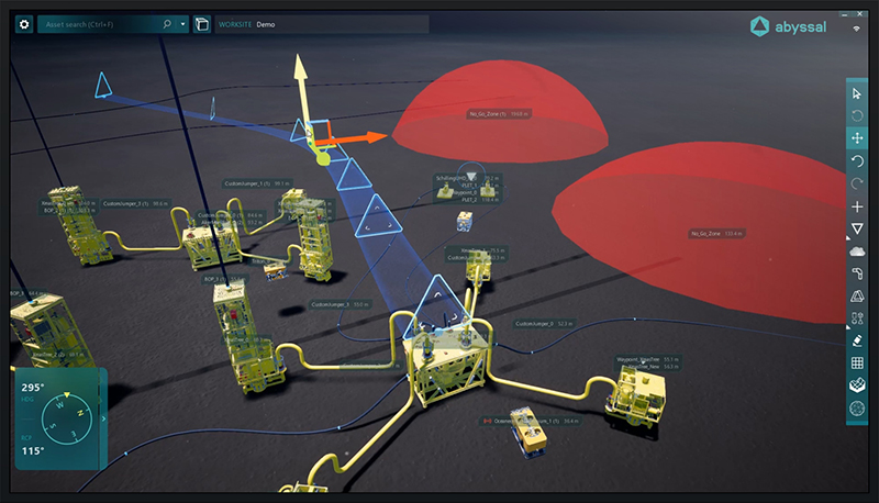
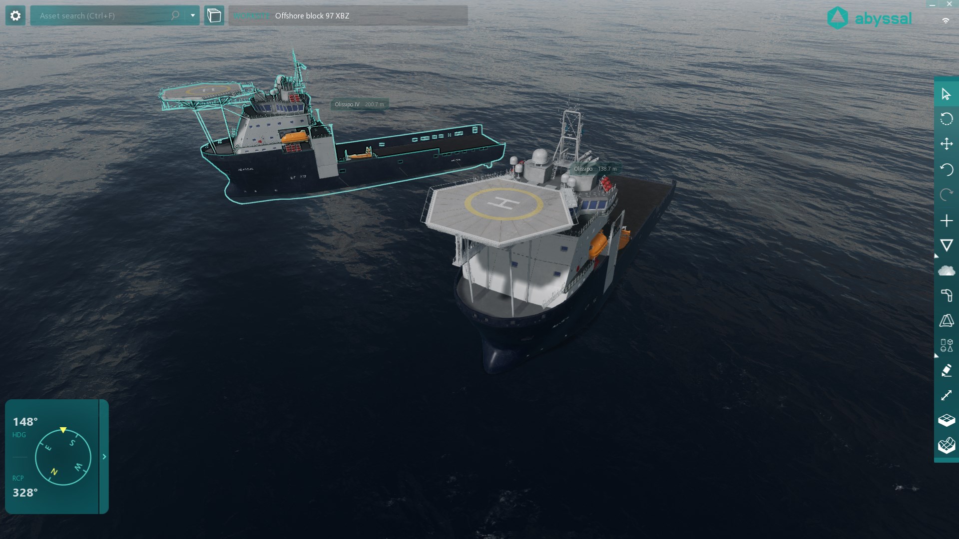
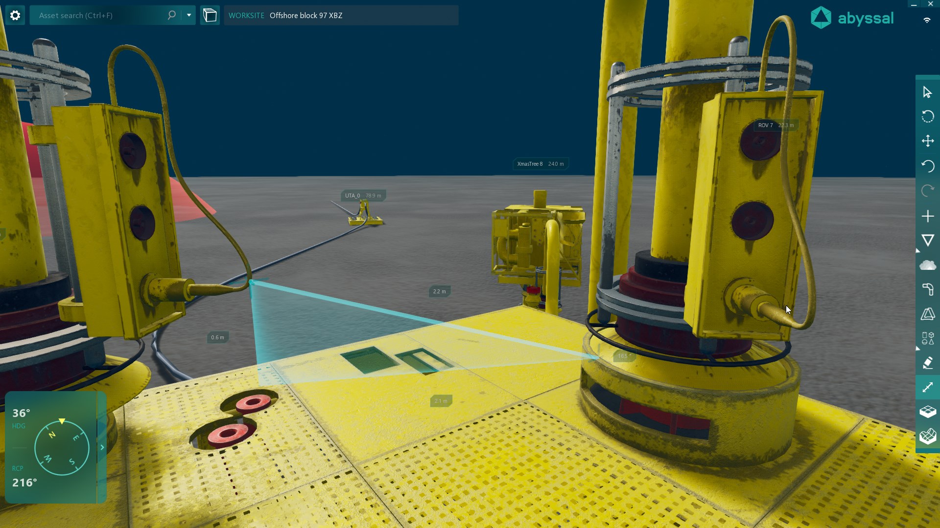
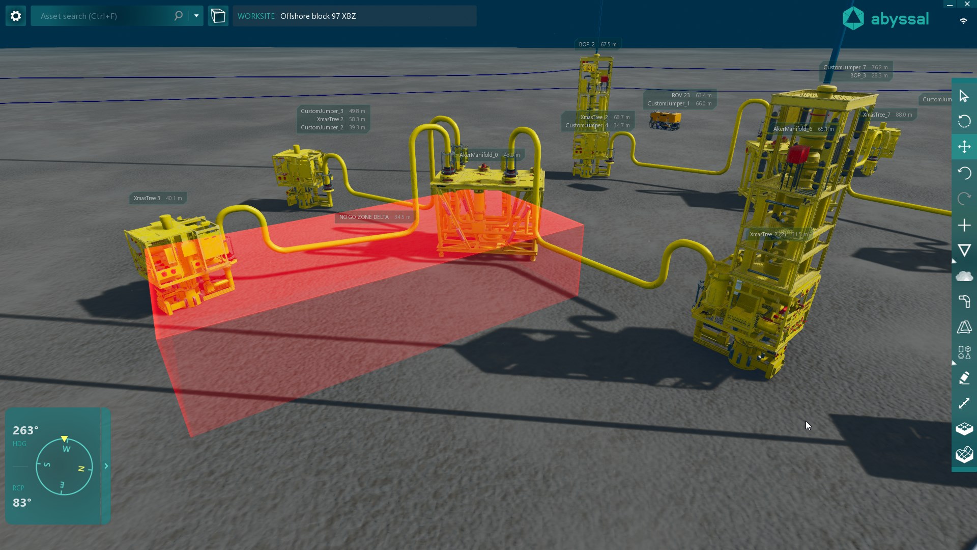
3D Viewer & Field Editor
Allows engineers and surveyors to add GIS-based contextualized data, such as routes, procedures, HAZID zones, identify risk areas, adjust pipelines, take precise measurements, etc.
An enhanced view of the subsea field that allows digital collaboration.
An enhanced view of the subsea field that allows digital collaboration.